Chamba district — Dalhousie, Khajjiar & Ancient Temple Kingdoms

Chamba District — Dalhousie, Khajjiar & Ancient Temple Kingdoms

Himachal Pradesh · Apr–Jun, Sep–Nov · 650–6400 m altitude

Quick Facts Places to Visit Food Plan Trip

About Chamba

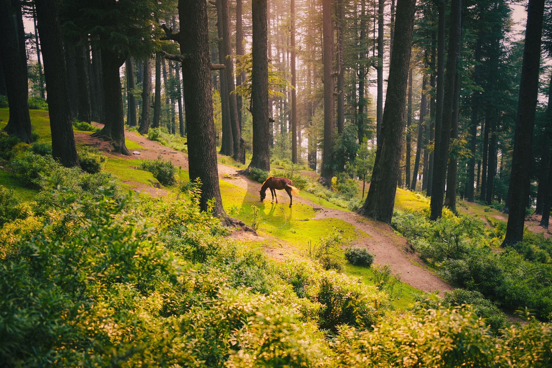
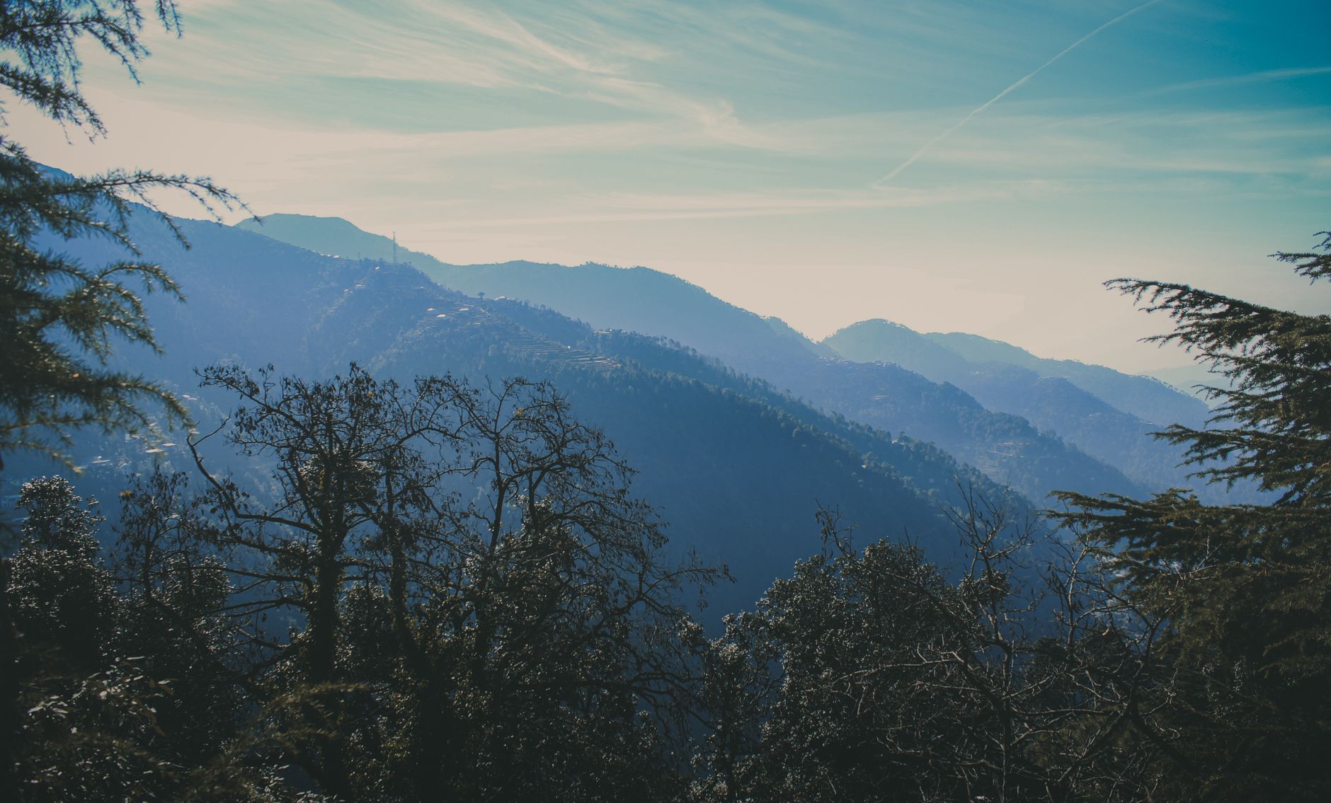
Chamba is one of Himachal's most underrated districts. The old Chamba town has preserved ancient temples dating back 1,000+ years. Dalhousie, a former British cantonment, offers colonial charm and access to Dainkund Peak. Khajjiar is often described as the 'Mini Switzerland of India' — a circular meadow ringed by deodars with a small lake. The Ravi and Chenab rivers drain through this westernmost district, and a network of high passes — Sach, Padri and Waru among them — connects Chamba to the remote Pangi valley and neighbouring Kangra and Lahaul.
Quick Facts

District HQ
Chamba
Area
6528 km²
Altitude
650–6400 m
Best Season
Apr–Jun, Sep–Nov
Summer Temp
15–30°C
Winter Temp
-5–10°C
Nearest Airport
Gaggal (Kangra) / Pathankot
From Delhi
553 km

Top Places to Visit (13)

Dalhousie

Dalhousie

2,036 m
  • Built in the 1860s as a hill station for British troops who could not afford to summer in Shimla, Dalhousie spreads across five hills at an average altitude of 2,036 m in the Dhauladhar foothills.
  • The cantonment character — churches, bungalows with verandas, pine-lined Mall roads — is better preserved here than in almost any other HP hill station, partly because the town never attracted significant industry or high-rise construction.
  • Subhash Chowk, the main square, anchors the central ridge; the two Mall roads, Upper and Lower, offer forest walks with views toward the Pir Panjal on clear days.
  • The writer Rabindranath Tagore and revolutionary Bhagat Singh both spent formative periods here.
  • Dalhousie is cold and green in summer, snow-covered and scenic in winter.
Khajjiar

Khajjiar

1,920 m5 km diameter at 1
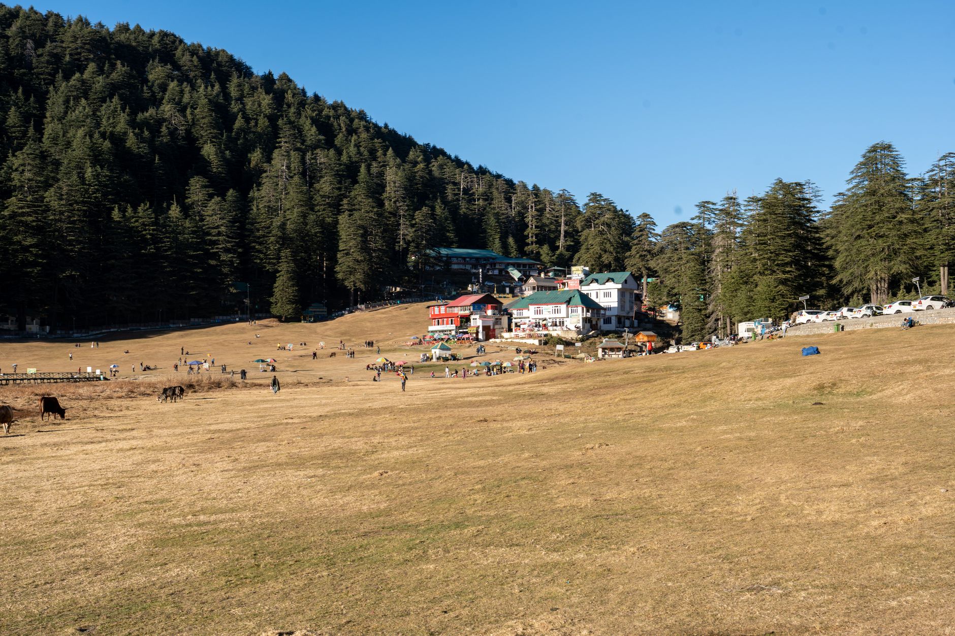
  • Twenty-two km from Dalhousie through dense deodar forest, Khajjiar occupies a circular natural plateau of approximately 1.5 km diameter at 1,920 m — a bowl of short-cropped grass around a small lake, enclosed by an unbroken ring of mature deodar trees, so symmetrically scenic that it has been officially designated as one of 160 locations worldwide similar to Switzerland, earning the 'Mini Switzerland of India' title from the Swiss Ambassador in 1992.
  • The Khajji Nag temple on the lake shore, dedicated to a serpent deity, is an ancient wooden structure predating the tourism.
  • A yellow signpost placed by the Swiss envoy who bestowed the 'Mini Switzerland' title marks the exact distance to Bern — 6,194 km — and a stone he carried home from Khajjiar now sits in a sculpture opposite the Swiss parliament building, a small but genuine two-way link between the meadow and the Alps.
  • Horse riding, zorbing and paragliding are offered on the meadow.
  • The sunset light through the deodars onto the lake is especially atmospheric.

Lama Dal Lake

3,960 m45 km from Chamba town
  • The largest of a cluster of seven high-altitude lakes near the historic Baleni pass, Lama Dal sits at 3,960 m below the Dhauladhar's inner slopes, ringed by permanent glaciers and bare granite that keep its water unusually clear.
  • Local Gaddi shepherds graze their flocks here through summer and visit the lake on Janmashtami, treating it as a sacred site of unknown depth.
  • The lake feeds a stream that runs west to form three more lakes in the same cluster — a rare chain of connected high-altitude waters rather than a single isolated tarn.
  • Reaching Lama Dal is a genuine trek — there's no road — which keeps it far quieter than Khajjiar or Dalhousie despite the scenery.

Mahakali Lake

4,080 mChurah tehsil
  • Lying between Sano and Gudial villages in Chamba's Churah tehsil, Mahakali Lake sits at 4,080 m — higher than nearby Khajjiar's meadow by more than 2,000 m — and stays frozen for roughly half the year, from November to April.
  • The lake is dedicated to the goddess Mahakali and is treated as sacred by nearby villages, similar in character to the smaller Ghadhasaru lake close by.
  • Its remoteness and altitude mean it's rarely visited outside the summer trekking window, offering a genuinely off-the-map alternative for travellers who've already done Khajjiar and Dalhousie.

Chhadasaru Lake

3,470 mChurah tehsil
  • Near Devikothi village in Churah tehsil, Chhadasaru Lake sits at 3,470 m at the base of its namesake peak, with a shoreline of about 1 km that local people hold sacred and visit for prayer at a small temple by the water.
  • It's a quieter counterpart to Mahakali Lake nearby — the two are often visited together by trekkers exploring the Churah interior, an area most Chamba itineraries skip entirely.
Chamba Town

Chamba Town

996 m
  • The ancient capital of the Chamba kingdom, continuously settled for over 1,500 years, lies in a bend of the Ravi river at 996 m — unusually low for a Himachal town, giving it a warm, almost subtropical climate compared to the surrounding ranges.
  • The Chaugan, a long open maidan in the town centre, is used for the Minjar Fair (August) — a week-long festival in which gods from 80+ surrounding villages are brought together in procession.
  • The Lakshmi Narayan temple complex on the hillside above the Chaugan contains six stone shikharas from the 10th–19th centuries, the oldest being among the finest examples of the Pratihara architectural style in the western Himalaya.
  • Chamba is also renowned for its Rumal — hand-embroidered silk cloth using a double-sided technique unique to the region.
Dainkund Peak

Dainkund Peak

2,755 m2 km trail from the Dalhousie ridge that passes through meadows of wild strawberry and alpine herbs before reaching the rocky summit
  • The highest accessible peak near Dalhousie at 2,755 m, Dainkund (sometimes called 'Singing Hill') is reached by a 2 km trail from the Dalhousie ridge that passes through meadows of wild strawberry and alpine herbs before reaching the rocky summit.
  • The Pohlani Mata temple at the top is tended by a family of priests who live in the adjoining shelter throughout the year, even through heavy winter snowfall.
  • The summit panorama takes in the Pir Panjal range to the north, the Ravi valley 1,000 m below, and on exceptionally clear winter mornings the plains of Punjab extending to the horizon.
  • The Indian Air Force maintains an installation on the ridge below the summit.

Kalatop Wildlife Sanctuary

  • Between Dalhousie and Khajjiar, the 30 sq km Kalatop Sanctuary protects a notable surviving blocks of Himalayan moist temperate forest in the Chamba district — a dense canopy of deodar, silver fir, oak and rhododendron that receives snowfall for 3–4 months annually.
  • The Kalatop Khajjiar Reserve contains black bear, leopard, yellow-throated marten, barking deer and over 100 bird species including the cheer pheasant (endangered).
  • A forest rest house in the middle of the sanctuary offers basic accommodation bookable through the Forest Department — among the most atmospheric lodging experiences in Chamba.
  • Walking trails through the sanctuary are open; a mandatory forest guard accompanies visits to the interior.
Manimahesh Lake

Manimahesh Lake

4,080 m13 km trail from Hadsar
  • At 4,080 m below the sacred peak of Manimahesh Kailash (5,653 m), this glacial lake is one of the holiest sites in Himachal Pradesh — Shiva is believed to reside on the mountain above, and the lake is considered his bathing pool.
  • The annual Manimahesh Yatra (August–September, timed to the Radha Ashtami festival) brings up to 100,000 pilgrims along a 13 km trail from Hadsar, making it one of the Himalayas' great devotional journeys.
  • Outside the yatra season the trail is almost empty and the landscape — moraines, alpine tundra, the dark lake and the white pyramid of Manimahesh — is strikingly austere.
  • The approach road from Bharmour to Hadsar passes through the sacred Gaddi tribal homeland.
Lakshmi Narayan Temple

Lakshmi Narayan Temple

  • The six-temple complex of Lakshmi Narayan in Chamba town represents the finest concentration of early medieval stone temple architecture in Himachal Pradesh.
  • The oldest and largest temple, dedicated to Lakshmi Narayan (Vishnu), was built in the Shikhara style in the 10th century by Raja Sahil Varman, who is said to have diverted the Saho spring to bring water to the town.
  • The stone carvings on the exterior walls — Vishnu in his ten avatars, Shiva with Parvati, celestial musicians and guardian figures — are of museum quality.
  • Inside the temples, bronze castings and silver-repoussé panels from the 10th–17th centuries are displayed.
  • The temples are active sites of worship and the priests are happy to explain the iconography.

Bharmaur

2,130 m
  • At 2,130 m on the Budhil river, Bharmaur was the original capital of the Chamba kingdom for 400 years before Raja Sahil Varman moved the court to Chamba town in the 10th century.
  • The Chaurasi (84) temple complex at its centre — a courtyard of 84 ancient shrines from the 7th to 10th centuries — ranks among the most significant ancient religious sites in the western Himalaya and yet receives only a trickle of visitors because of the difficult access.
  • The main Manimahesh and Lakshmi Narayan temples in the Chaurasi complex are still active.
  • Bharmaur is also the cultural and economic centre of the Gaddi tribe — the pastoral transhumant community whose shepherds take their flocks over 4,000 m passes between the Chamba winter pastures and the Lahaul summer meadows.

Sach Pass

4,390 m
  • At 4,390 m, the Sach Pass ranks among the most technically demanding high-altitude roads in India — a single-lane track carved into sheer rock faces above a 2,000 m void, crossing the Great Himalayan Range to link the Chamba Valley with the Pangi Valley.
  • The road is unpaved, subject to landslides and snowfall from October to June, and passable only in 4WD vehicles with experienced drivers.
  • The pass is flanked by permanent snowfields even in August, and the final approach involves river crossings and switchbacks of extreme gradient.
  • This place is precisely this difficulty that makes the journey extraordinary: the view from the pass north into the Pangi valley is of a landscape that looks quite different from the better-known in the accessible parts of Himachal.

Pangi Valley

  • The Pangi Valley of the upper Chenab river is among the most isolated inhabited valleys in India — cut off by snow for five to six months annually, with road access only through the Sach Pass or the long route through Lahaul.
  • The Pangwali people who inhabit Pangi's 40+ villages have a distinct culture, dialect and traditional costume that has been preserved by centuries of seasonal isolation.
  • The valley receives almost no tourists outside the July–September window, and those who arrive find landscape of extraordinary severity: narrow gorges, rushing rapids and steep slopes with tiny terraced fields clinging to impossible angles.
  • The Forest Department rest house at Kilar village is the only formal accommodation.

Local Food & Cuisine

MadraBabruMitha (sweet rice)Chamba ChukhDham (feast on leaf plates)

Famous For

Khajjiar (Mini Switzerland)DalhousieManimahesh YatraChamba Rumal handicraft

Plan Your Chamba Trip

Talk to our local experts. Best packages, handpicked hotels, private cabs.

WhatsApp Us — Free Itinerary

Chamba Travel Guide: Places to Visit, Routes & Itinerary

Planning a trip to Chamba in Himachal Pradesh? Use this guide to discover tourist places, practical routes, sightseeing ideas and itinerary options. Himachal Explorer connects destination information with road-route planning so you can compare places and build a realistic day-wise trip.

For visitors searching for chamba district tourist places, khajjiar, dalhousie and manimahesh travel guide, this page brings together the key locations and travel-planning information in one place. You can also explore the Himachal tourist places map, compare Himachal tour packages, or use the Himachal trip planner to create a custom route.