Kangra district — Paragliding Capital — Dharamshala, Tea & Dhauladhar

Kangra District — Paragliding Capital of Asia

Himachal Pradesh · Mar–Jun, Sep–Nov · 400–5000 m altitude

Quick Facts Places to Visit Food Plan Trip

About Kangra

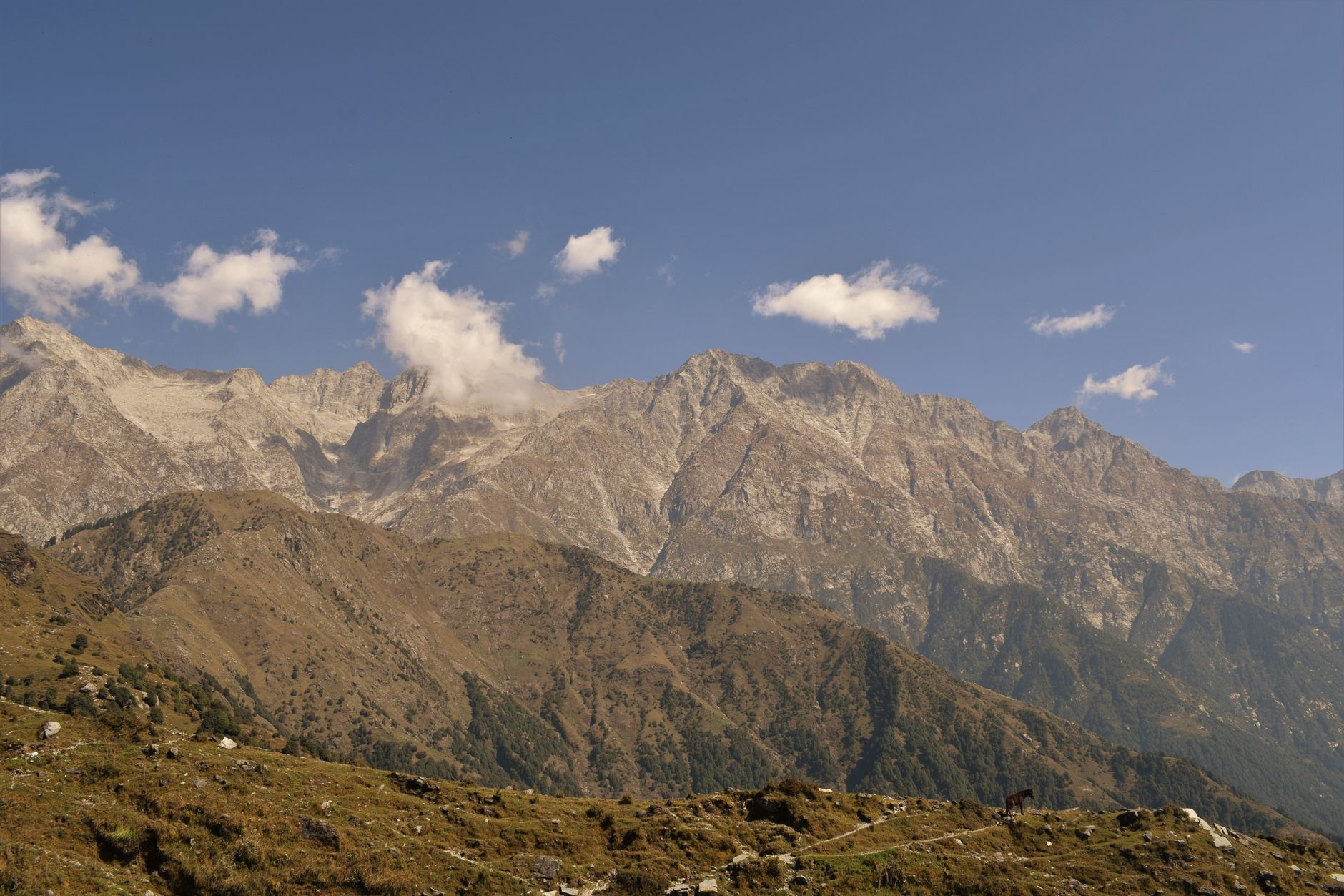
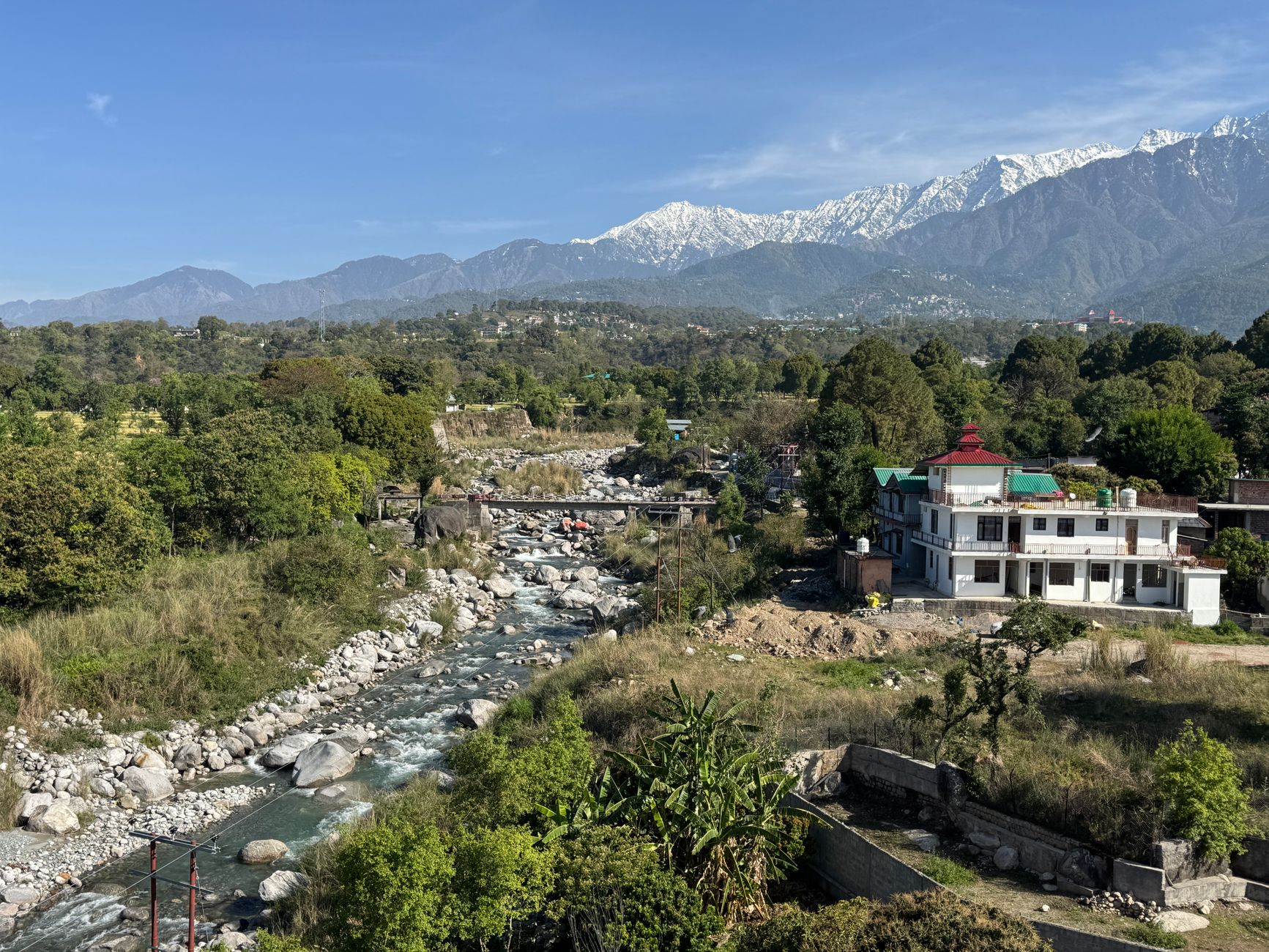
Kangra is Himachal's most populated and culturally rich district. Dharamshala contains the Dalai Lama and the Tibetan government-in-exile. Bir-Billing is the paragliding capital of Asia, hosting World Cup events. The Kangra Valley Railway is a delightful narrow-gauge journey. The ancient Kangra Fort, Brajeshwari temple and tea gardens of Palampur make this a district of extraordinary diversity. Beyond Triund, the high-altitude Indrahar Pass crosses the Dhauladhar range into Chamba — one of several historic passes, alongside Tori Jot and Talang, that have linked the two districts for centuries.
Quick Facts

District HQ
Dharamshala
Area
5739 km²
Altitude
400–5000 m
Best Season
Mar–Jun, Sep–Nov
Summer Temp
15–35°C
Winter Temp
0–15°C
Nearest Airport
Gaggal (Kangra Airport)
From Delhi
490 km

Top Places to Visit (10)

Dharamshala / McLeod Ganj

Dharamshala / McLeod Ganj

500 m
  • Dharamshala is in fact two distinct towns separated by 500 m of altitude: lower Dharamshala, the administrative headquarters at 1,457 m; and McLeod Ganj (upper Dharamshala) at 1,457 m where the Central Tibetan Administration and the Dalai Lama's residence have been established since 1960.
  • McLeod Ganj is a living expression of Tibetan civilisation in exile — the Namgyal Monastery, the Tibet Museum, the Library of Tibetan Works and Archives, and dozens of meditation and yoga centres create a community that is simultaneously a spiritual destination and a political story.
  • The surrounding landscape, with the Dhauladhar range rising sharply behind the town and the Kangra Valley spread below, is dramatic.
  • The town is best visited March–May and October–November when the Dhauladhar is snow-capped and the monsoon or heat are not factors.

Bir Billing

2,400 m60 km or more
  • The village of Billing at 2,400 m is the certified take-off point and Bir at 1,400 m the landing zone for what is officially designated the paragliding capital of Asia — a classification earned by consistent conditions that produce thermals of 3,000 m+ height gain, enabling cross-country flights of 60 km or more.
  • The Paragliding World Cup, held here in alternate years, brings pilots from 40+ countries.
  • Beginners can complete a tandem flight with a certified instructor in 15–25 minutes; advanced pilots plan multi-hour free flights north toward Mandi.
  • The Bir colony, a settlement of Tibetan refugees, has excellent cafes and guesthouses and a distinctive cultural character blending Himachali and Tibetan life.
Palampur

Palampur

1,220 m5 km south
  • At 1,220 m on the lower slopes of the Dhauladhar, Palampur is Himachal Pradesh's tea capital — the only significant tea-growing region in the state, established by British planters in the 1860s using bushes brought from Darjeeling.
  • The vivid green of the tea terraces against the snow backdrop of the Dhauladhar is a striking landscape.
  • Neugal Khad, a narrow gorge carved by the Neugal stream just west of town, is a dramatic viewpoint and picnic site.
  • Tashijong monastery, 5 km south, is a major Drukpa Kagyu centre with scenic wall paintings and a traditional crafts workshop.
  • The town has well-maintained colonial-era buildings and is a useful base for exploring both the lower Kangra Valley and the Billing paragliding site.
Kangra Fort

Kangra Fort

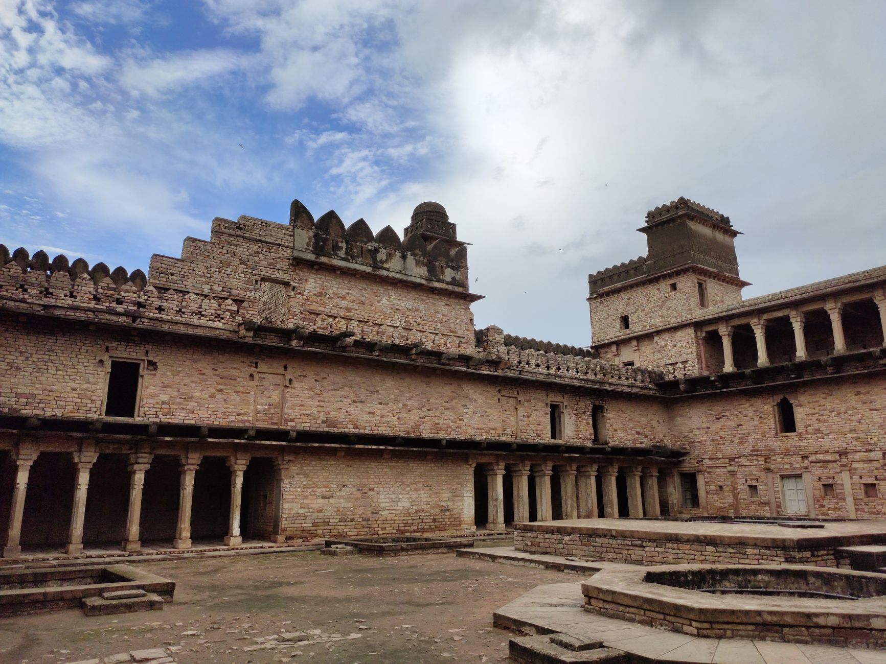
  • Rising on a rocky promontory at the confluence of the Baner and Majhi rivers, the Kangra Fort is one of the oldest forts in India — historical records place settlements on this site from the 3rd century BCE, and it was described by the armies of Mahmud of Ghazni in 1009 CE as the richest fort in Asia.
  • The fort withstood repeated sieges before falling to the Mughal emperor Akbar in 1620; it was damaged irreparably by the 1905 Kangra earthquake.
  • The ruined walls, towers and temple platforms still occupy an impressive area, with the Ambika Devi and Lakshmi Narayan temples inside the compound retaining their sanctity.
  • The Archaeological Survey of India manages the site and has partially restored the entrance gateways.

Triund Trek

2,828 m9 km trail from McLeod Ganj that ascends through oak and rhododendron forest before emerging on a long grassy ridge directly beneath the Dhauladhar's vertical rock face
  • The Triund ridge (2,828 m) is accessed by a 9 km trail from McLeod Ganj that ascends through oak and rhododendron forest before emerging on a long grassy ridge directly beneath the Dhauladhar's vertical rock face.
  • The contrast is abrupt and spectacular: the trail that passes through dense forest delivers walkers without warning to an open meadow with a sheer 1,500 m cliff rising immediately behind and the entire Kangra Valley spread 1,400 m below.
  • The trek takes 3–4 hours ascending, 2–3 hours descending, and is suitable for reasonably fit walkers.
  • Overnight camping on the ridge, in tents rented from Gaddi shepherd families, transforms the experience — dawn light on the Dhauladhar is memorable.
  • The Snow Line Café at the ridge serves chai and dal; beyond it, the trail continues to Lahesh Cave and the Indrahar Pass (4,342 m).

Masrur Rock Cut Temple

  • Carved in the early 8th century from a single massive sandstone outcrop in the Beas valley, the Masrur temples are among the most remarkable and least-visited heritage sites in northern India — a group of 15 interconnected shikharas cut directly into a natural hillside in the late Pratihara style.
  • Partially destroyed by the 1905 earthquake and never fully excavated, the temples contain carved panels of Shiva, Vishnu and their attendants of considerable artistic refinement.
  • The reservoir created below the rock reflects The temple site at sunset, creating a photographic composition particularly scenic.
  • Masrur is often compared to the Ellora caves and sometimes called 'the Kangra Khajuraho'; This place is inexplicably absent from most tourist itineraries.

Brajeshwari Temple

  • Immediately adjacent to the Kangra Fort on the same rocky outcrop, the Brajeshwari Devi temple is one of the 51 Shakti Peethas — the sacred sites marking where the body of the goddess Sati fell according to Puranic tradition.
  • The temple was demolished by Mahmud of Ghazni in 1009 CE, and rebuilt multiple times; the 1905 earthquake destroyed the current structure's predecessor.
  • The temple receives especially large numbers of pilgrims during the Navratri festivals (March–April and September–October).
  • The gold-plated shikhara, rebuilt after 1905, gleams above the surrounding old bazaar of Kangra town, which retains its traditional street of cloth merchants and sweets shops.
Kareri Lake

Kareri Lake

2,950 m14 km trail from Dharamshala winds through dense oak and rhododendron forest
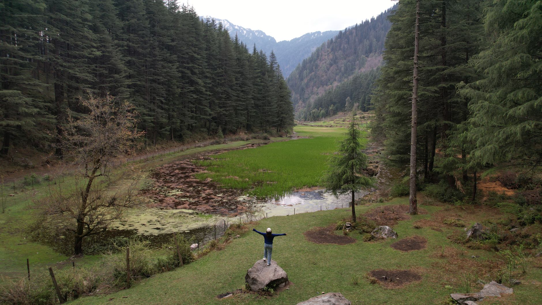
  • A 14 km trail from Dharamshala winds through dense oak and rhododendron forest, crossing the Kareri stream multiple times on rope bridges and stepping stones before reaching this glacial lake at 2,950 m directly beneath the Dhauladhar's northern face.
  • The lake freezes completely in winter and is surrounded by snow on its northern shore until late May.
  • Trout have been introduced and the clear water supports a healthy population.
  • Camping is permitted on the flat ground at the lake's eastern shore; basic food is available from a seasonal dhaba.
  • The continuation trail climbs to the Minkiani Pass (4,350 m) for experienced trekkers with high-altitude gear.
  • Kareri is a full-day excursion from Dharamshala or a more satisfying 2-day trip with a night camping at the lake.

Dharamkot

  • A kilometre above McLeod Ganj on a forested spur, Dharamkot has evolved into Himachal's most concentrated centre for yoga, meditation and Vipassana practice.
  • Dozens of centres offer courses ranging from drop-in yoga classes to month-long residential programmes in the Tibetan Buddhist, Vipassana, Kundalini and Ashtanga traditions.
  • The village has strong cafes, a small traveller library and guesthouses in converted apple orchards.
  • The trail to Triund begins here, and the short walk to the Guna Devi temple viewpoint offers the same Kangra Valley panorama without the full trek commitment.
  • Dharamkot attracts a throughout the year community of long-stay international visitors seeking study and practice in an unhurried mountain setting.

Chamunda Devi

  • Set on a cliff above the Baner river gorge, the Chamunda Devi temple ranks among the most revered Shakti shrines in Himachal Pradesh — the fierce goddess in her form as destroyer of the demons Chanda and Munda is worshipped here in a form considered particularly powerful.
  • The temple site, rebuilt in the mid-20th century on an ancient site, receives large numbers of pilgrims throughout the year, swelling enormously at Navratri.
  • The gorge viewpoint adjacent to the temple, where the river has cut a narrow canyon through the Shivalik foothills, is atmospheric.
  • The town of Chamunda, below the temple, has a traditional bazaar and several dharamshalas for pilgrims.

Local Food & Cuisine

KhachdiChukh (spicy fermented chilli)Momos (Tibetan)ThukpaKangri Dham

Famous For

Dalai Lama residenceParagliding at Bir-BillingKangra Miniature PaintingsTea Gardens

Plan Your Kangra Trip

Talk to our local experts. Best packages, handpicked hotels, private cabs.

WhatsApp Us — Free Itinerary

Kangra Travel Guide: Places to Visit, Routes & Itinerary

Planning a trip to Kangra in Himachal Pradesh? Use this guide to discover tourist places, practical routes, sightseeing ideas and itinerary options. Himachal Explorer connects destination information with road-route planning so you can compare places and build a realistic day-wise trip.

For visitors searching for kangra tourist places, dharamshala, mcleod ganj, palampur and bir billing, this page brings together the key locations and travel-planning information in one place. You can also explore the Himachal tourist places map, compare Himachal tour packages, or use the Himachal trip planner to create a custom route.