Lahaul & Spiti district — Cold Desert — Monasteries Above the Clouds

Lahaul & Spiti District — Cold Desert — Monasteries Above the Clouds

Himachal Pradesh · Jun–Sep · 3000–6500 m altitude

Quick Facts Places to Visit Food Plan Trip

About Lahaul & Spiti

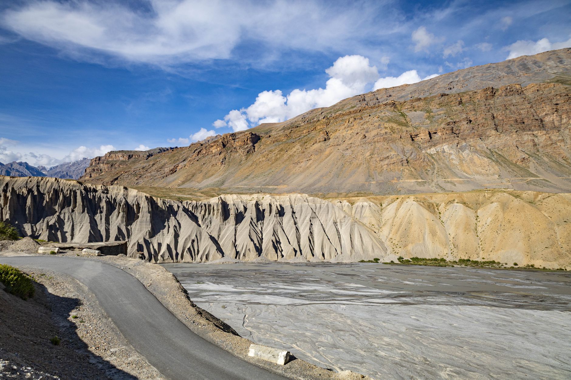
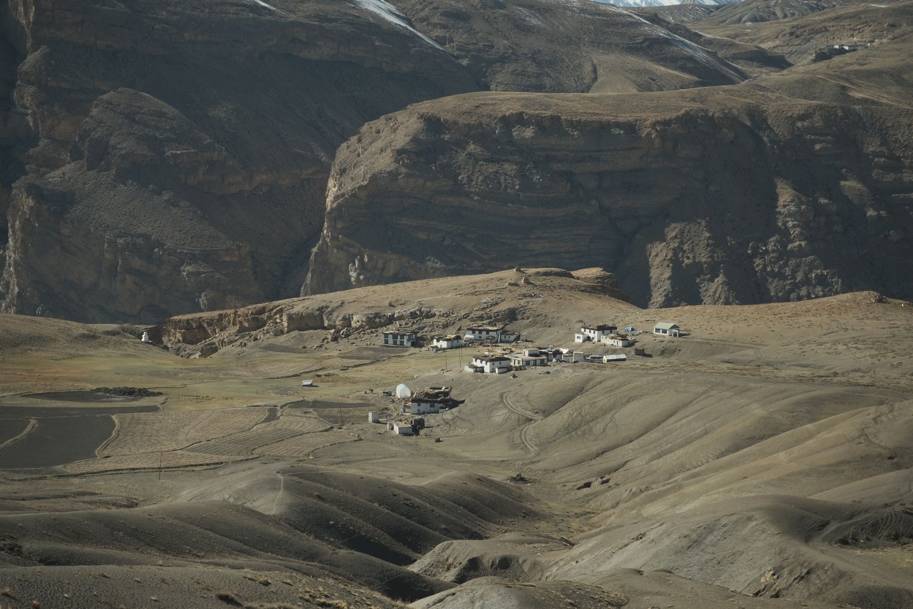
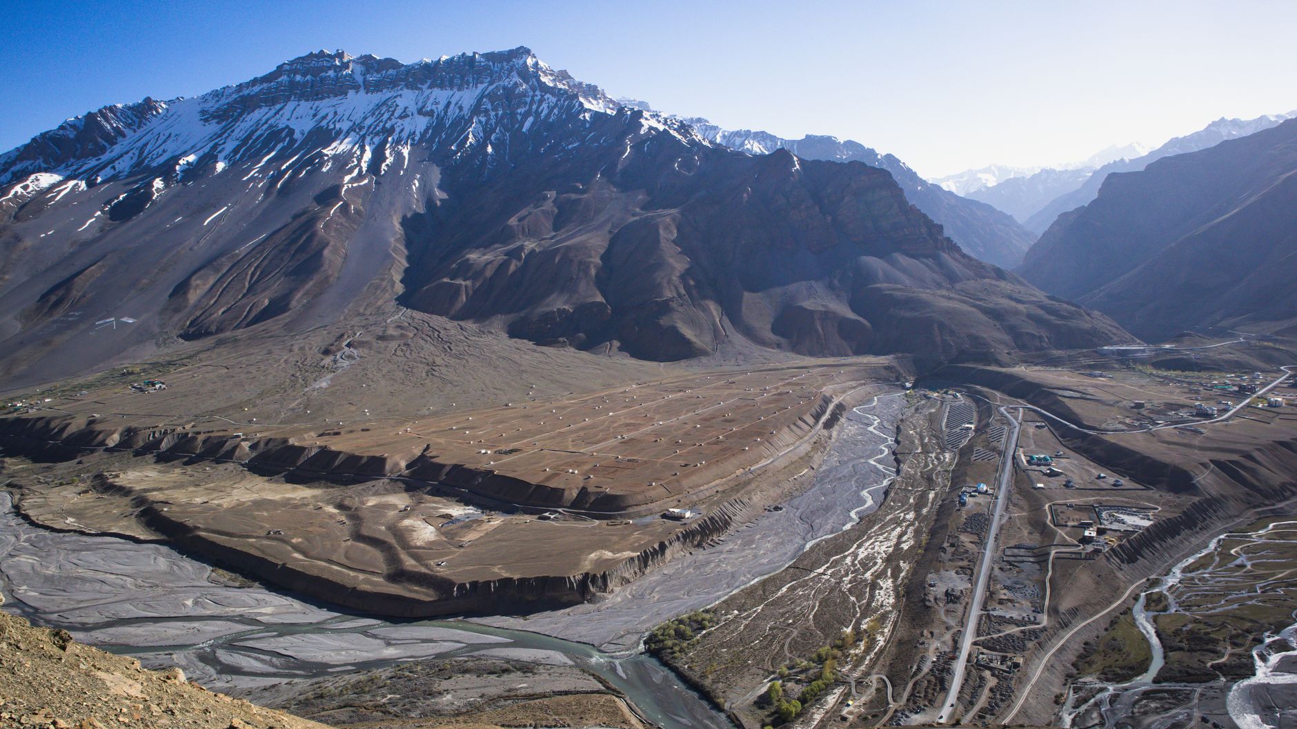
Lahaul & Spiti is the largest and most remote district of Himachal Pradesh — a high-altitude cold desert averaging 4,000 m. Accessible via Rohtang Pass (from Manali) or Kinnaur route. The Spiti Valley contains some of the world's oldest Buddhist monasteries: Key, Tabo (1,000 years old), Dhankar. The landscape is stark, lunar and striking. Chandratal lake is one of India's most photographed Himalayan lakes.
Quick Facts

District HQ
Keylong (Lahaul), Kaza (Spiti)
Area
13835 km²
Altitude
3000–6500 m
Best Season
Jun–Sep
Summer Temp
5–25°C
Winter Temp
-30–0°C
Nearest Airport
Bhuntar (Kullu) / Chandigarh
From Delhi
700 km

Top Places to Visit (11)

Kaza

Kaza

3,800 m
  • At 3,800 m in the Spiti river valley, Kaza is the administrative and logistical hub of Spiti sub-division — a compact town of whitewashed government buildings, a busy market street and a growing number of guesthouses and cafes that cater to the summer influx of motorcyclists and trekkers.
  • The New Kaza market area has ATMs, a petrol pump, medical centre and mobile data connectivity (BSNL), making it a critical resupply point before heading to the higher villages.
  • The old Kaza fort ruins on the ridge above town offer views down the valley to the confluence of the Pin and Spiti rivers.
  • Most visitors use Kaza as a 2–3 night base from which to explore Key, Kibber, Langza, Hikkim and the Pin Valley.

Key Monastery

4,166 m
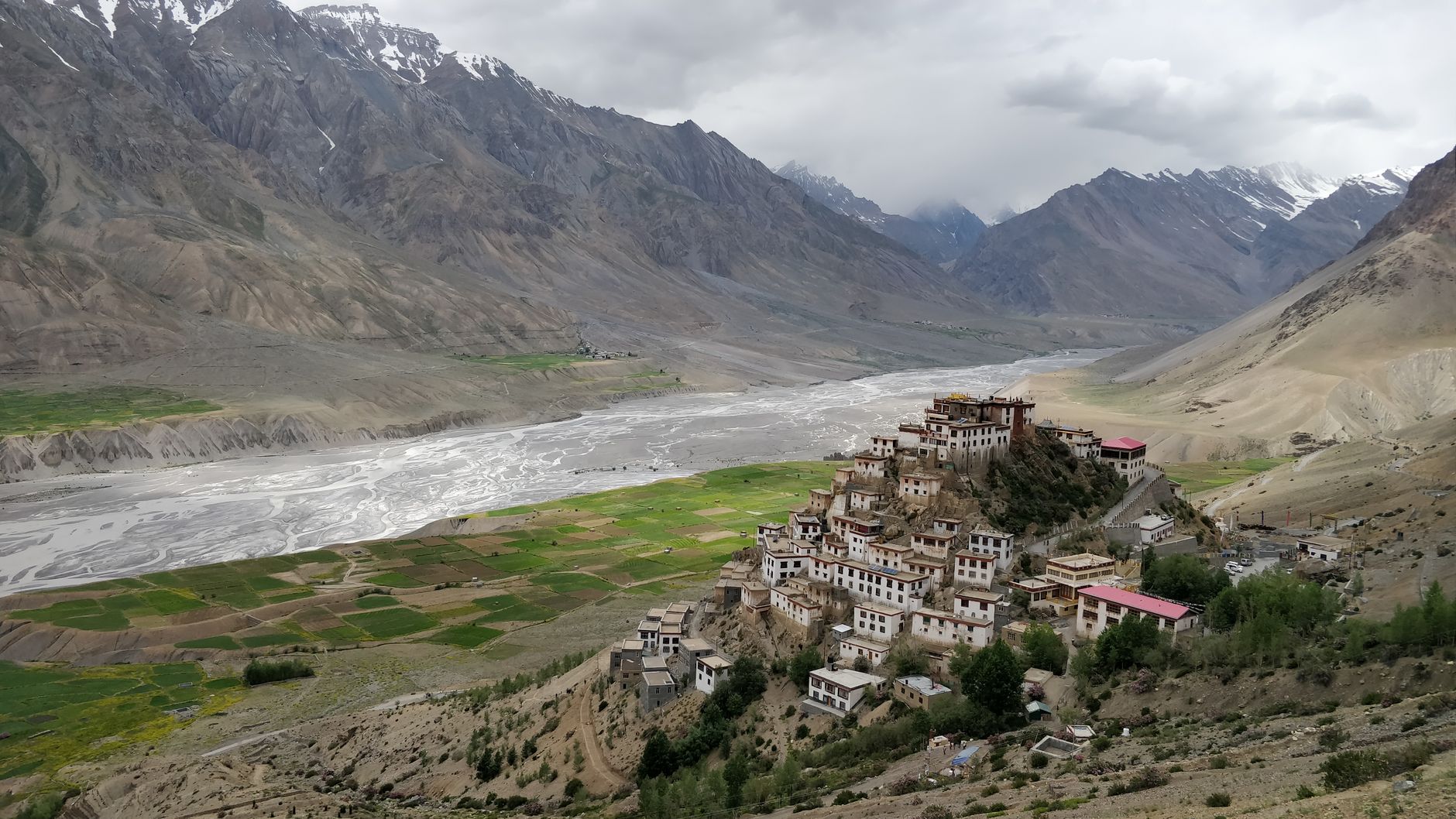
  • Perched on a conical hill at 4,166 m above the Spiti river, Ki (Key) Gompa is the largest and most visited monastery in the Spiti Valley — a white-washed labyrinth of prayer halls, monks' quarters and meditation rooms that has expanded organically over 1,000 years.
  • The oldest sections date to the 11th century, and the monastery was damaged repeatedly by Mongol raids, earthquakes and fire before its current form was consolidated.
  • Inside, ancient thangka paintings, butter sculptures and ritual objects fill the dimly lit shrines.
  • The summer festival (June–July) brings the monastery alive with masked cham dances performed by resident monks.
  • Resident monk numbers fluctuate between 250 and 300, and the monastery runs a school for young monks.

Chandratal Lake

4,250 m14 km on a rough track
  • Translated as 'Moon Lake', Chandratal sits at 4,250 m in a glacial bowl near the Kunzum Pass, its crescent shape giving it its name when viewed from the ridges above.
  • The water is an extraordinary deep blue-green, reflecting the surrounding moraines and the snow peak of Chandra Bhaga in extraordinary clarity at dawn before the winds arrive.
  • Camping is permitted 500 m from the lake shore (no camping on the lake margin); the site has basic toilet facilities and a small dhaba that operates in season.
  • The approach road from Batal, 14 km on a rough track, is passable in 4WD vehicles from June to early October.
  • The lake is considered sacred by Buddhists, and legend holds that fairies come to bathe here on moonlit nights.

Suraj Tal

4,880 mnear Baralacha Pass
  • Just below the Baralacha Pass at roughly 4,880 m, Suraj Tal — 'Lake of the Sun' — is the third-highest lake in India, an emerald sheet of water that mirrors the barren peaks around it with striking clarity.
  • It is the source of the Bhaga river, which meets the Chandra river downstream at Tandi to form the Chandrabhaga — the river that becomes the Chenab once it crosses into Jammu & Kashmir.
  • The lake sits directly beside the Leh-Manali highway (NH3), making it an easy stop for travellers crossing Baralacha rather than a dedicated trek, though the road is closed by snow most of the year.
  • Its stark, near-treeless setting is a good preview of the high cold-desert landscape that continues north into Ladakh.
Tabo Monastery

Tabo Monastery

3,050 m
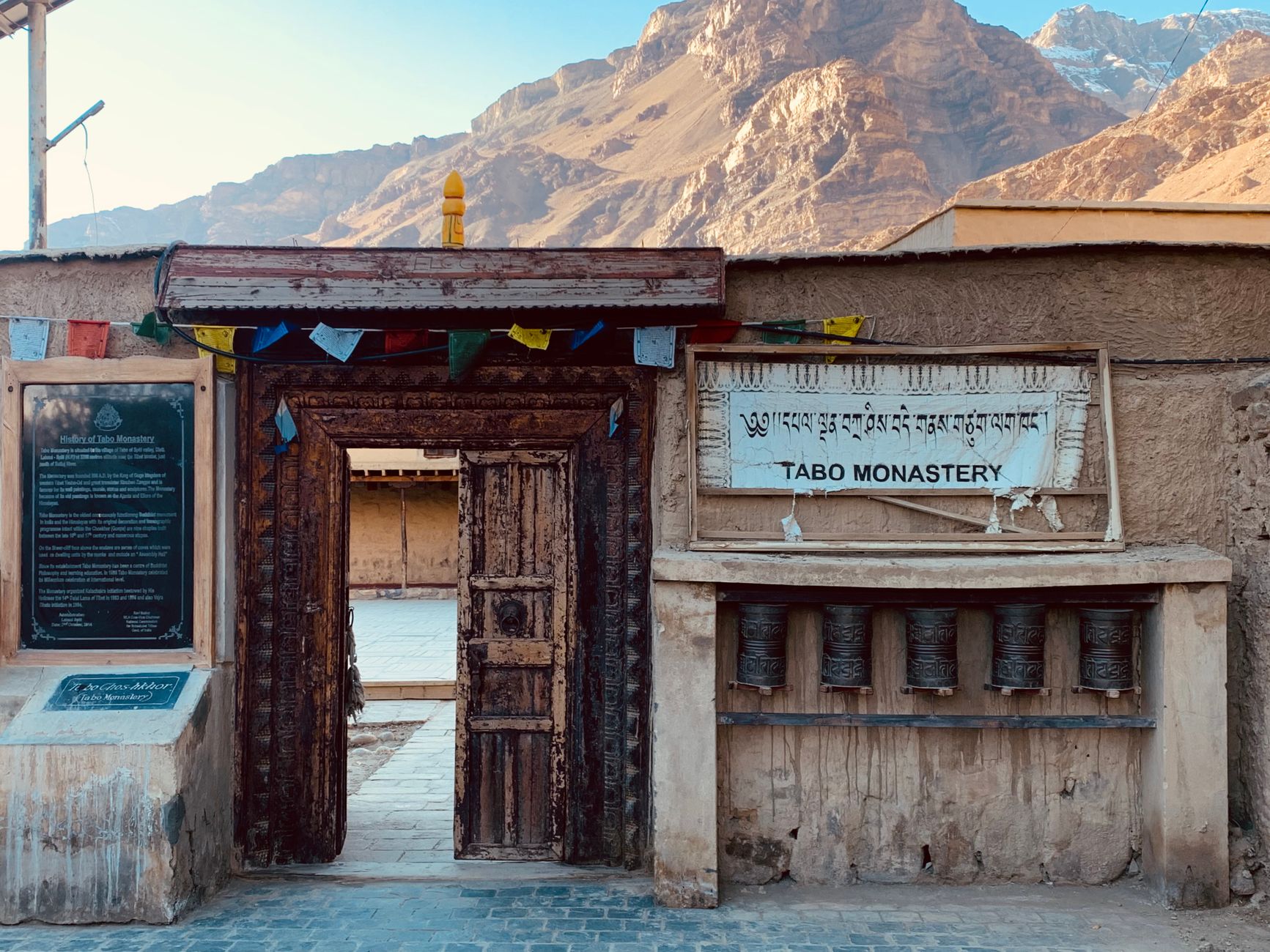
  • Founded in 996 CE by the Tibetan Buddhist scholar Rinchen Zangpo, Tabo is the oldest continuously functioning monastery in the Himalayan region and among the most remarkable surviving examples of medieval Buddhist art anywhere in Asia.
  • The main Dukhang (assembly hall) and nine other temples contain exquisitely preserved 10th–12th century mud-plaster murals, clay sculptures and stucco figures in a style that bridges the Kashmiri and Central Asian traditions.
  • The Dalai Lama has expressed a wish to retire here.
  • Tabo village, at 3,050 m on the banks of the Spiti river, is quieter and warmer than Kaza, making it an ideal overnight stay before or after visiting Chandratal via the Pin Valley.

Dhankar

1,000 m
  • The medieval village of Dhankar clings to a near-vertical cliff face at the confluence of the Spiti and Pin rivers, its 1,000-year-old monastery and crumbling fort seemingly defying gravity above a 1,000 m drop to the valley floor.
  • The 4th-century fort ruins above the monastery hold copper-age inscriptions and command among the most dramatic viewpoints in the Spiti Valley.
  • A 1-hour trail from the village leads to the Dhankar Lake — a small glacial tarn at 4,100 m surrounded by rough moraines.
  • The monastery itself, though structurally fragile, contains important murals and hosts a small resident community of monks.
  • Dhankar receives a fraction of the visitors that Key does, preserving a palpable sense of solitude.
Pin Valley National Park

Pin Valley National Park

3,500 m
  • Covering 675 sq km of the Pin river watershed at altitudes between 3,500 m and 6,600 m, Pin Valley National Park is one of India's highest protected areas and one of the best places in the world to sight snow leopards in their natural habitat.
  • The park protects a transition zone between the moist alpine meadows of the Greater Himalaya and the cold desert of the Tibetan plateau — a habitat mosaic that supports snow leopard, Himalayan wolf, Tibetan wild ass (kiang), Himalayan ibex and over 100 bird species.
  • The main valley road from Attargo to Mud village (4,050 m) passes through the park; the inner areas require a wildlife department permit and a registered guide.
  • Winter (November–March) is the best season for snow leopard sightings when prey ibex descend to lower elevations.

Hikkim

4,400 m
  • At 4,400 m on the plateau above Kaza, Hikkim holds the distinction of being home to the world's highest functioning post office — a small white building where travellers queue to send postcards stamped with the coveted 'Hikkim' postmark that collectors prize.
  • The village of a few dozen houses grows peas and barley in the short growing season and is inhabited throughout the year by families who winter at lower elevations.
  • The plateau walk from Hikkim to Komic village (one of the world's highest motorable villages) across open tundra, with views to the Kinnaur Kailash range, is a notable short walks in Spiti.
  • The clarity of night sky here, far from any light pollution, makes Hikkim exceptional for astrophotography.
Langza

Langza

4,400 m
  • At 4,400 m on the same plateau as Hikkim, Langza is distinguished by a giant white Buddha statue overlooking the village and valley — and by an extraordinary geological phenomenon: the surrounding hillsides are rich in marine fossils, ammonites and trilobites preserved in the ancient Tethys Sea sediments that now form these Himalayan heights.
  • Local children sell fossils to visitors; removing geological specimens is technically prohibited, though the trade persists.
  • The village commands an unobstructed view of the Chau Chau Kang Nilda peak (6,303 m).
  • The combined Langza–Hikkim–Komic plateau circuit (half-day by vehicle, full-day on foot) ranks among the most rewarding excursions from Kaza.

Rohtang Pass

4,111 m
  • The Rohtang Pass (4,111 m) functions as the great gateway of Lahaul — the point at which the monsoon-fed green world of the Kullu Valley abruptly gives way to the rain-shadow landscapes of Lahaul and ultimately Spiti.
  • For Lahaul, Rohtang is not a visitor attraction but a lifeline: the pass closes from November to May under heavy snowfall, cutting Lahaul off from Manali and the outside world until the Atal Tunnel (opened 2020) changed the equation throughout the year.
  • The approach from the Lahaul (northern) side is gentler than the Kullu face, passing the Chandra river headwaters and the vast flat Lahaul valley dotted with poplar trees and whitewashed gompas.
  • The Atal Rohtang Tunnel at 3,100 m is now the practical route; the pass itself is visited as an excursion from Manali.

Sissu

5 km north of the Rohtang Tunnel's northern portal
  • In the green Lahaul valley just 5 km north of the Rohtang Tunnel's northern portal, Sissu is a revelation after the stark landscapes further north — a village of emerald fields, poplar windbreaks and apple orchards backed by a hanging glacier that sends a spectacular waterfall down a basalt cliff face into the Chandra river below.
  • The flat valley floor here is good cycling territory, and the village guesthouses offer the most comfortable accommodation between Manali and Kaza.
  • The Gemur monastery, a 12th-century Tibetan Buddhist site, sits above the village on a pine-forested slope.
  • Sissu has become increasingly popular as a weekend destination from Manali since the Rohtang Tunnel opened.

Local Food & Cuisine

Tsampa (roasted barley)Chhang (fermented barley beer)ThukpaButter Tea (Po Cha)

Famous For

Key MonasteryChandratal LakeTabo 1000-year monasterySnow LeopardHighest villages

Plan Your Lahaul & Spiti Trip

Talk to our local experts. Best packages, handpicked hotels, private cabs.

WhatsApp Us — Free Itinerary

Spiti Valley Travel Guide: Places to Visit, Routes & Itinerary

Planning a trip to Spiti Valley in Himachal Pradesh? Use this guide to discover tourist places, practical routes, sightseeing ideas and itinerary options. Himachal Explorer connects destination information with road-route planning so you can compare places and build a realistic day-wise trip.

For visitors searching for spiti valley travel guide, kaza, key monastery and chandratal, this page brings together the key locations and travel-planning information in one place. You can also explore the Himachal tourist places map, compare Himachal tour packages, or use the Himachal trip planner to create a custom route.